Tampilkan postingan dengan label sc. Tampilkan semua postingan

April 21 22 Charleston SC to Wrightsville Beach NC 155 7 Miles

We left at 10 as planned, but I screwed up reading the tide table so the tide was against us on the way out of Charleston, though weakly. We put up the main in the inner harbor and jibed it several times on the way out, past Fort Sumter where our Civil War began. Actually it began in SC, earlier, with the thinking of Calhoun, on the theory of states rights to "nullify" federal authority, a doctrine now becoming popular again among the lunatic right in this country.
We turned left as soon as we reached the first buoy after the end of the seawall and put up the genoa as well. This was before noon but the wind was too weak and too far behind us, to move the boat with  any speed, so we motor sailed, mostly motored, until about 1:30. I even had taken down the mainsail. I had not realized how much of the first 109 mile long part of this passage, was more easterly than northerly and so the projected five to ten knots of west wind was behind us. Then came wind, much stronger than projected and a gift to us. I was able to get up half the mainsail, with double reef in it, and continued with the genoa. The wind built behind us and we were screaming along at seven to eight knots with peaks at 8.9. And with the wind about 120 to 150 degrees from our bow, we rolled a lot from side to side, most unpleasant. Lene felt a bit nauseous though she did not lose her food. We had a delicious cold dinner -- no cooking with the rolling. It was warm and sunny by day and reasonably warm at night, with no rain. But during the night we got some slow speeds, less than four knots and even though I did not put up the genoa again until near daybreak, it was this night part, as well as the first few hours, where we lost time
After dinner, at 7:30, we replaced the genoa with the small jib, a safety measure for nightime sailing in big waves, and were still making over seven knots with just the small headsail and double reefed main. We had put on the preventer to prevent accidental jibe of the mainsail, and with the small jib sliding back and forth we took it in and sailed under just double reefed main. The preventer was a good thing because the wind had shifted from off our starboard quarter, to off the port quarter during Lenes watch. We were sailing "by the lee" -- the way you get that accidental jibe. When I got up at one (Lene let me sleep late) we jibed the main and continued on toward the turning point - off the tip of Frying Pan Shoals, which extend many miles out into the Atlantic from the Cape Fear River. We saw very little traffic: Two big freighters passed us at quite respectable distances -- closest point of approach being miles away -- and one sailboat overtook us, headed for Beaufort. I saw his lights and estimate he was 200 yards off our starboard side, moving a fraction of a knot faster than ILENE. Prior to the close passage I had a radio conversation with him to confirm what each of us was going to do.
Once around Frying Pan, at about 4 to 5 am, we turned north to Wrightsville (The Masonboro Inlet) and the wind came up from our port quarter to its beam and even forward of that. This second leg was only 32 miles and wind speed varied considerably during the leg, as, consequently, did boat speed.
It is hard to get good pictures of a night passage so at least I have the long awaited dawn.
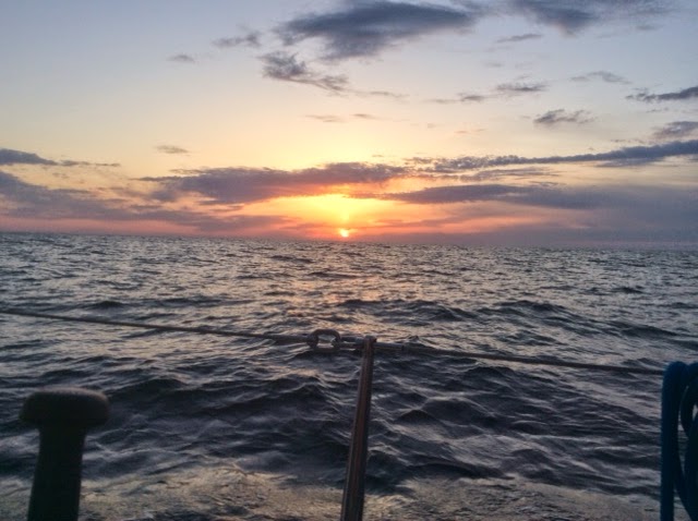
Masonboro Inlet is easy, wide, well marked and flanked with seawalls. Once in, it is easy to get to the anchorage area and we dropped at 1:30, only 90 minutes "late" compared to our projected schedule that would have averaged 6.5 knots. Nice homes line the bay side of the barrier island.
We put out a lot of chain because there is lots of room and 20 knots were predicted for this evening. But by 4 pm it was howling at up to 40. We visited Wrightsville and made the reciprocal of this same ocean passage, to Charleston on our way south last fall and hence felt no need to lower and raise the dink to stretch our legs in Wrightsville. Tomorrow: Beaufort NC, about 80 miles and if the forecast comes true, a beam reach  or close reach from the port side, with five to fifteen knots.
I  tried to take a photo of the pod of dolphins playing under and around our bow, taking the Ipad up there, but they are way faster than ILENE at eight knots. I took maybe 50 shots and only one, a video of less than one second, caught a dolphin. These were not the slow graceful swimmers in the ICW but racers amidst the big ocean waves. I couldnt get the video into this post but it is on Facebook. I did manage to neither fall off the boat nor drop the camera.
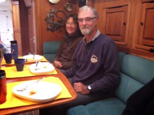
Ilene is a true member of this crew and a solid citizen on overnight passages. She grumbles a bit and still relies on me, and I have to admit I like the  second part of that. She is even taking an interest in the charts, tides and weather. I couldnt make this trip without her, physically, mentally or emotionally. We have some chores that each of us do most of, but both of us do many of the chores. She said she liked our 25.5 hours together.
On our honeymoon on the old ILENE, in August 2002, we spent a pretty terrible 36 hours in a noreaster off the coast of Maine  The boat got beat up (torn sail, water inside through the dorades, compass light out) and we got beat up too. After a good nights sleep Lene asked, "Where do we go next?"  I replied "God, I married the right woman!"  And that has become truer with each passing year.
Read More..

April 17 19 Redbird Creek to Beaufort SC and Two Lay Days There 66 5 Miles

We hauled the anchor at 7:15 to get to Hell Gate about 30 to 60 minutes before high tide at 8:40, measured at a tide station only 2.5 miles from that canal. It was cold and windy -- in the wrong direction -- but we passed through Hell Gate with no less than nine feet of depth -- about six more than would have been there at low tide. We got such an early start and partial favorable tides, that we changed our destination from Bull Creek to Beaufort SC, which had been scheduled as the next days destination; we got onto a mooring, rather than their dock where we had stayed our last two times here at 5:05 pm.  Generally the tides were running to the sea from high tide near Hell Gate for six hours and then rushed upstream. The course was so circuitous and involved going upstream on some rivers and down on others that it was always a surprise to us when we entered a new segment to find out which way the tide was flowing. With 2500 rpms on the Yanmar our speed varied from 4.8 to 8.4 knots depending on the current. Maybe some Comp Sci Ph.D. could solve the riddle of when is the best time to leave from point A to go to Point B, depending on your boats speed, unadjusted for tide, and the date in the lunar cycle. But I cant game nature. I mentioned hairpin curves and here is an early part of the passage
from the pliers at the right, through Hell Gate  at the screwdriver tip, upper right, past one hairpin curve above the big washer to just above the wrench jaw at the left. Overall,  the course for this segment was about 30 degrees, or north of northeast.
The portion of the days passage before we got to and crossed the Savannah River was new to us. It took us past Thunderbolt, the boating capital of Georgia. We had heard so much about this place, so close to Savannah, including that the marina brings you a free Krispy Kreme doughnut in the morning. Here are its boatyard and marina and a big beauty. I wonder how she got in this far from the sea with her mast vastly exceeding 65 feet in height.


We also passed Paris Island and Hilton Head, both of which I mentioned during our voyage south last fall.  We tried to motor sail in the afternoon, when we got to Port Royal Sound and the Beaufort River the last 14 miles, but the wind had died down and our speed brought it to our nose.
Our stay in Beaufort was quiet. Unlike our last two visits here, we took one of the marinas moorings. We used the marinas courtesy car to spend $290 at the Publix on Ladies Island, across the river. We off loaded several days of our garbage, filled our four one gallon water bottles, met with friends, including a pot luck dinner ashore. We had planned only one lay day, but the forecast weather seemed worse on the second lay day and we like it here so we stayed.
We made a date with Carla, co-owner of another Saga 43, "Reverie", as she was driving past this town between Charleston and Brunswick. But she had a friend as a passenger who did not want to stop, so our rendezvous had to be put off until the fall when, hopefully, Carla and John, who we have not yet met in person, will be driving through New York on a day when we will be there.
We spent some time discussing whether to divide the segment from Beaufort to Charleston into two halves, as we did on the trip south, but in the end decided to go almost all the way to Charleston and anchor in the Stono River, just south of the city. This solution avoids two problems. 1. It is hard to find a berth in Charleston due to Race Week. 2.  There is a strong tide under a bridge that is closed for rush hours which we have to pass at the end of another long day, just before Charleston.
We saw a matinee of Noel Cowards "Blithe Spirit", at the USC Beaufort campus theater. We sat next to Louise and Jim, nice folks, who recommended "Narrow Dog to Indian River" by Terry Darlington, which I am recommending to Dick and Elle.
Though in a university setting, the show was put on by the local theater group and funny, a farce: during a seance with a medium a mans wife comes back as a ghost visible only to him and torments his new wife. And only $20 per ticket for good seats.
And having had dinner and breakfast at Low Country Produce, located in the former City Hall, during our trip south, we had lunch there this time. Innovative inexpensive food in a place with cloth napkins  which also retails its food; one sits among display cases and racks.
The dink is hauled and we have to get underway early tomorrow to make the 7 am opening of the Ladies Island Bridge, less than a quarter mile away, or wait until 9:00.
Read More..

November 13 and 14 Charleston to Tom Point Creek to Beaufort SC 60 6 Miles


Charleston is like New York in at least one way: both were started at the confluence of two rivers, and the point of juncture is a park and called The Battery.
It is surrounded by lovely stately old homes.  But you cant sail by close because a sand spit extends out from the point.

A pretty easy day of it, 9:45 to 3 pm, motoring all the way in the ICW, which was wide and deep. Cold but not unpleasantly. We made a connection with the boat next to us in the Charleston Marina, "Kachina", a Hans Christian 33, with the most beautifully treated teak.
It is sailed by John and Joanna currently from Colorado but originally from Canada and Marthas Vineyard, respectively. We exchanged cell numbers and stayed close to them all day. We had originally selected Steamboat Creek for the midway anchorage to Beaufort, but Lene read about Tom Point Creek after it was recommended by Jim of "Goldie,"
a home made, steel, blue schooner. So the Admiral changed our destination. The two creeks are only about a mile apart.
The only obstacle today was one low bridge that opens every half hour from 9 to 3:30, only about 4.5 miles from the marina. We left when we were ready and the marina had sent a man to help a boat come in, so he stayed and helped us get off. But it was too late for the 10 am opening so we went very slow for the first 4.5 miles and got there in time for the 10:30 opening and still had time to get through Elliot Cut before its very swift tidal flow turned against us at 11:15.  After anchoring,  I lowered the dink and used it as a platform to get some rust stains out and polished some stainless, before being chased inside by the cold. A cold front with stronger winds passed during the period midnight to 2AM, but our anchor held.

Where is Tom Point Creek, you asked? Oh, it flows into the Wadmalaw River. It runs between Stann and Little Britton Islands. Still no help? Well you wont find Tom Point Creek in Google, except for information on the tides there, but it is about 20 feet deep and just wide enough for a single column of boats to anchor, and swing with the tidal change; a strong tidal current runs through it, For the curious, look in Google Earth at 32 degrees, 38.75 minutes North; 80 degrees, 16.86 minutes West.  It is bordered by salt marshes on both sides
and the book said -- and correctly so -- that dolphins swim up the creek, playful looking but looking for food.


In the morning all six of us had mango pancakes before setting off at about 9:30.
Joanne and Jim

Jim and Susan
Both John and Jim are very handy, the former a carpenter and boat builder, the latter a mechanic who built Goldie and who has lived aboard for 40 years. Both are professional delivery captains so they know something about sailing, in fact, a lot!
When we pulled the hook I did the math: with the Ladies Island Bridge, near Beaufort, closed from 4 to 6 and it being dark by six, we needed speed to get to that Bridge, from which is less than 1/4 mile more to the Downtown Marina of Beaufort. We supplemented the engines power with the small jib and trimmed it on every point of sail during the twisting ICW to gain an extra knot or two. We slowed down only in the three "Cuts" between different rivers. The cuts were short but reported to be shallow, though no problem for us today. A passing shrimp boat, its wings out, surrounded by its posse:
 We made the 3 pm opening, with the grace of the kindly bridge tender. The hundred cars and trucks lined up waiting until 3:06 when we passed, may not have thought of her so kindly, though. I think it was Lenes feminine voice that prevailed upon her to wait for us.

We plan to be on docks, here and in Hilton Head, for several days, using dock power to provide heat until the polar vortex goes away.


Read More..

November 15 to 17 Three Lay Days in Beaufort SC Zero Naut Miles

Here is that Ladies Island Bridge, first from land, closed, and then from ILENE at the dock, open, with just a few of the waiting cars at the extreme left.

It was cold but the third day has been warm but first windy and then rainy. The wind pushed us hard on the dock, separated by our somewhat flattened fenders. Several boats that were anchored out dragged into the marshes.
Lene used the Downtown Marinas courtesy car for groceries and to obtain this Mr. Heater Buddy,
which burns propane, producing carbon monoxide and hence is not as safe as using the electricity driven heat exchanger, but used when we are not at a dock and carefully, for small periods of time while we are awake, it can take the chill off in the evening and early morning.

I washed the boat, cleaned the starboard rub rail with acetone and waxed it; not much for three days, I confess. I also plotted a whole bunch of alternative courses between here and St. Marys, where we want to arrive a few days before Thanksgiving for the festival there. All the way from a single 125 mile overnight passage to as many as four intermediate stops, each such shorter hop or combinations of them by the inside and outside routes. It all depends on the winds, as always. Each such potential course except the inside ones, consist of three segments: to get out to the sea, in the sea and coming in from the sea.
Beaufort is a very historical town and the county seat and site of a US District Courthouse (federal court), as well as a tourist town with many shops, galleries and restaurants. I checked out the mostly used bookstore with a huge selection of books by Pat Conroy, and an antique shop with a nice selection of antique nautical charts. The restaurant we found and patronized this time is Low Country Produce, located in the tile walled former post office and town hall. It has good reasonably priced innovative cuisine and sells groceries as well. We bought a jar of their pickled Jerusalem artichokes after having been given a few with our dinner.
I visited the John Mark Verdier House,
right on the main street, Bay Street, which survived the war and several fires since 1804. It is the site of the historical society but they offer only guided tours of the house, which they do not conduct for only one person, so I saved $10 and contented myself with viewing the public rooms.
I had never thought that the Union army "occupied" the South during the war, but they did occupy Beaufort, because it was a harbor from which, through port Royal Sound (where a multi-ship naval battle was fought) they could operate the blockade of the Confederacy to choke off revenues from the sale of Sea Isle cotton, the finest grade, to England. The white confederate residents fled leaving their property (slaves) behind, so missionaries came in to help them, as well as merchants, newspaper publishers, photographers and carpetbaggers of all types. Many of the buildings on Bay Street survived to this day and a diorama was created of them and,from photographs, of the others.

Robert Smalls was a slave who had been stationed on a cargo ship, the "Planter". He put his wife and family aboard and brought the ship to the Union forces and surrendered. For this daring heroic act he was given command of a Union warship, later granted prize money with which he built a house here in town and was elected several times to the US House of Representatives.

But perhaps the best part of this town was just walking among the old homes and the magnificent live oak trees with Spanish moss that grace them.


This last one is Bythewood (two sylables not three), built in the 18th Century by the sea captain of that name and perhaps our favorite. The owner, Heather Perl, came along, took this picture and invited us for dinner. Maybe on the way back we can take her up on that.

We finally met up again with Dean and Susan of "Autumn Borne", who have appeared in this blog several times since we met them, coincidentally here in Beaufort, in the spring of 2012.


We also met their friends (our new friends), Benny and Lisa of "Rhiannon," a 42 foot Catalina. We six shared a pot luck dinner and played  and a game of cards.

Read More..

April 20 Beaufort SC to Charleston SC 57 2 Miles

I forgot something that happened in Beaufort, probably because Id rather not remember. While we were in the theater we heard a loud storm going on outside. Some water came into the boat through the mast boot but that was easily picked up. I learned to dispose of a used American flag with respect. We had retired one at the beginning of this cruise which had been torn to tatters by the wind. But the wind tore our newish flag -- and its flagpole -- off from the boat. I will figure out a more secure way of attaching the next one.
Yes, I know I said we had decided to anchor in the Stono River, just short of Charleston, but our speed was so good today that we made the 3:30 opening of the Wappoo Creek Bridge and never had to deal with the fact that if you dont make the 4:00 opening, you have to wait until 6;30. It seems by dumb luck, we had favorable tide and the deep water of high tide most of the nine hours we were underway from 7 am to 4:00 pm. The favorable tide is proven by our average speed - 6.3 knots.
I have thought of several additional reasons why it is impossible for that hypothetical Ph.D. to figure out a tide algorithm. It depends on where in the river you sail: in the center the tidal flow is different from nearer the sides. It varies during the six plus tide cycle, slow at the beginning and end and fast in the middle. At bends in the river, one side flows faster than the other. And when you add in motor-sailing, as we did all day today, your speed will depend on the wind direction and speed which vary from minute to minute, relative to the boats course which was a near continuous curve, and on the diligence and skill of the trimmer. Today the wind was generally from near our stern and the small jib self jibed many times, as it is designed to do. I hope to never mention that crazy hypothetical algorithm again.
It was a cool but not cold day, warming up in the afternoon, with hazy sun poking amidst the light clouds. No rain.
We had two small problems near the end. I bumped into the throttle lever while walking past the binnacle, decellerating our RPMs and bringing back the "alignment" problem that we hoped we had fixed. The rattle was back and big time. But coming to neutral and building up the RPMs slowly -- the rattle was gone again. Something is still wrong and needs to be fixed. Shortly after this I think I caught a crab pot float on our rudder. The wheel became very heavy to turn and our speed was considerably slowed. I think that a crab pot was the cause of the problem but we dont really know. I turned the boat several times and slowed her and if it was a crab pot float, it fell off.
One of the crew at work, doing what he does second best (first is eating!)


Here is Charleston from our anchor on the Ashley River. On our two prior visits here we took a dock at an excellent marina on the Cooper River, on the north side of town, which was full tonight. But we had no plans for sight seeing this time and did not lower the dink.

We have also determined, subject to plans D, E and F, etc., tomorrows (and the next days) passage: to the Masonboro Inlet and the anchorage of  Wrightsville Beach. At 6.5 knots this will take 24 hours, anchor to anchor. We plan to leave about 10 A.M., with favorable tide flushing us out. Decent wind from the west is predicted.
We have also determined our planning deadline for arrival back in NYC -- June 7. Lenes niece, Barbi, and her son, Trevor who we hung with in Amsterdam last June, are visiting and will arrive on June 10. We would like to get home a few days earlier to get settled and unpacked, and those few days also serve a second purpose: as a buffer in case bad wind prevents the Atlantic overnight up the Jersey coast, as it did when I helped Jim bring his 26 foot "Aria" up in about 1996.
Read More..