Tampilkan postingan dengan label beach. Tampilkan semua postingan

April 21 22 Charleston SC to Wrightsville Beach NC 155 7 Miles

We left at 10 as planned, but I screwed up reading the tide table so the tide was against us on the way out of Charleston, though weakly. We put up the main in the inner harbor and jibed it several times on the way out, past Fort Sumter where our Civil War began. Actually it began in SC, earlier, with the thinking of Calhoun, on the theory of states rights to "nullify" federal authority, a doctrine now becoming popular again among the lunatic right in this country.
We turned left as soon as we reached the first buoy after the end of the seawall and put up the genoa as well. This was before noon but the wind was too weak and too far behind us, to move the boat with  any speed, so we motor sailed, mostly motored, until about 1:30. I even had taken down the mainsail. I had not realized how much of the first 109 mile long part of this passage, was more easterly than northerly and so the projected five to ten knots of west wind was behind us. Then came wind, much stronger than projected and a gift to us. I was able to get up half the mainsail, with double reef in it, and continued with the genoa. The wind built behind us and we were screaming along at seven to eight knots with peaks at 8.9. And with the wind about 120 to 150 degrees from our bow, we rolled a lot from side to side, most unpleasant. Lene felt a bit nauseous though she did not lose her food. We had a delicious cold dinner -- no cooking with the rolling. It was warm and sunny by day and reasonably warm at night, with no rain. But during the night we got some slow speeds, less than four knots and even though I did not put up the genoa again until near daybreak, it was this night part, as well as the first few hours, where we lost time
After dinner, at 7:30, we replaced the genoa with the small jib, a safety measure for nightime sailing in big waves, and were still making over seven knots with just the small headsail and double reefed main. We had put on the preventer to prevent accidental jibe of the mainsail, and with the small jib sliding back and forth we took it in and sailed under just double reefed main. The preventer was a good thing because the wind had shifted from off our starboard quarter, to off the port quarter during Lenes watch. We were sailing "by the lee" -- the way you get that accidental jibe. When I got up at one (Lene let me sleep late) we jibed the main and continued on toward the turning point - off the tip of Frying Pan Shoals, which extend many miles out into the Atlantic from the Cape Fear River. We saw very little traffic: Two big freighters passed us at quite respectable distances -- closest point of approach being miles away -- and one sailboat overtook us, headed for Beaufort. I saw his lights and estimate he was 200 yards off our starboard side, moving a fraction of a knot faster than ILENE. Prior to the close passage I had a radio conversation with him to confirm what each of us was going to do.
Once around Frying Pan, at about 4 to 5 am, we turned north to Wrightsville (The Masonboro Inlet) and the wind came up from our port quarter to its beam and even forward of that. This second leg was only 32 miles and wind speed varied considerably during the leg, as, consequently, did boat speed.
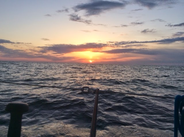
It is hard to get good pictures of a night passage so at least I have the long awaited dawn.
Masonboro Inlet is easy, wide, well marked and flanked with seawalls. Once in, it is easy to get to the anchorage area and we dropped at 1:30, only 90 minutes "late" compared to our projected schedule that would have averaged 6.5 knots. Nice homes line the bay side of the barrier island.
We put out a lot of chain because there is lots of room and 20 knots were predicted for this evening. But by 4 pm it was howling at up to 40. We visited Wrightsville and made the reciprocal of this same ocean passage, to Charleston on our way south last fall and hence felt no need to lower and raise the dink to stretch our legs in Wrightsville. Tomorrow: Beaufort NC, about 80 miles and if the forecast comes true, a beam reach  or close reach from the port side, with five to fifteen knots.
I  tried to take a photo of the pod of dolphins playing under and around our bow, taking the Ipad up there, but they are way faster than ILENE at eight knots. I took maybe 50 shots and only one, a video of less than one second, caught a dolphin. These were not the slow graceful swimmers in the ICW but racers amidst the big ocean waves. I couldnt get the video into this post but it is on Facebook. I did manage to neither fall off the boat nor drop the camera.
Ilene is a true member of this crew and a solid citizen on overnight passages. She grumbles a bit and still relies on me, and I have to admit I like the  second part of that. She is even taking an interest in the charts, tides and weather. I couldnt make this trip without her, physically, mentally or emotionally. We have some chores that each of us do most of, but both of us do many of the chores. She said she liked our 25.5 hours together.
On our honeymoon on the old ILENE, in August 2002, we spent a pretty terrible 36 hours in a noreaster off the coast of Maine  The boat got beat up (torn sail, water inside through the dorades, compass light out) and we got beat up too. After a good nights sleep Lene asked, "Where do we go next?"  I replied "God, I married the right woman!"  And that has become truer with each passing year.
Read More..

Virginia Beach Project Update

After letting the last coat of epoxy on the hull dry for several days I did minimal touch up sanding of high spots. As I look back I should have done a lot more from an appearance standpoint but it certainly has a passable appearance. I again wiped the hull down well after having vacuumed the garage so that I was in as dust free as possible. I then used masking tape around the gunwale line feeling that the glue would probably adhere better to the epoxy directly than to a coat of paint. I used Rustoleum Marine primer, one coat applying it with a foam roller. It was difficult paint to stir and get well mixed but it went on very well and the roller gave it a good smooth even appearance. I again let it dry well for a couple of days and then used Rusteolem Marine Topsides paint for a finish coat. It too was rolled on and was easy to use. It will take a second coat to achieve a really nice look. It should be noted that this is Topsides paint not designed as “bottom” paint so if you plan on leaving a boat in the water for any long periods of time this is not the paint to use.


One final comment on the paint. Compared to the usual marine paints Rustoleum is much cheaper but also offers a more limited choice of colors and it would appear that it is not designed to be used as a mixing base to make your own color.


I let her get good and dry and then flipped her over onto a nice soft cloth pad to protect the paint. The frames were still attached and were the way I supported the boat while painting. Now for the first time I got a good look at the inside of the boat. WOW! I had a lot of finishing to do. This included filling screw holes but mainly if was filling in and making filets were the chines, keelson etc. did not seal as tightly as I would have liked. From a functional standpoint the boat was sealed. From and esthetic one I had a lot of work ahead of me. Since the epoxy is pricey I mixed up just enough so I knew that there would be no waste. This was your peanut butter consistency and applied with a tongue depressor went on easily and gave a nice effect. I would give a piece of advice when doing this. Wipe off the excess with a vinegar soaked cloth as soon as you are finished with an area. It is a heck of a lot easier than sanding this rock hard stuff once it dries. 


I still had the frame “legs” uncut. The center ones in particular were a real nuisance to work around so I cut them off almost to where they will be finally but since I still have work to do on the sheer as far as trimming off the plywood I left a few inches that will come off later. Now I at least wasn’t catching myself on this stick that was serving no purpose. The bow and stern legs weren’t nearly the problem and I still haven’t touched them. I went off the CABBS plans for the mast step and thwart. I saw in someone’s plans that they had enclosed this part and made a buoyancy box out of it. I used ¼” maranti for the top which I fitted up tight to the underside of the inwales. Put a few cleats along the sides and fore piece to hold it tight. I then scribed a pattern on cheap plywood for the vertical piece. For this I used ½” maranti figuring that this would be extra cross bracing since I am using ½” plywood instead of the ¾” per plans. I will cut a 2 3/8” hole at the point 11” back from the bow and into this will go a piece of 2” PVC. When finished it will be sealed with epoxy.

What I haven’t got straight (so to speak) yet is the rake of the mast and exactly how the step will be angled. The mast will be reinforced 1 ½” PVC. From what I can tell, and Kyle Leonard has said, the mast should be perpendicular to the sheer line That is what I finally did. I took a piece of 1x4 sprude, used a 2 3/8’ hole saw an cut completely though it and attached it to the keelson in just the right position so that the 2” pPVC would be perpendicular to the sheer line. Not as difficult as it may sound. Used epoxy to fasten it. I put in a 4” water tight inspection port in the vertical piece a little off center so that the area may be used to store a towel etc. I will have pictures of all this. The port cover is frm West Marine and cost less than $10. Really happy with it. As looked at the inside of the bow transom it just looked unfinished so I took a piece of 1x4 spruce, as clear as I could find, and scribed a piece to fit on the inside of the bow on top of the mast thwart. I think it looks pretty good. I am doing the same on the stern with the exception that there will be a perpendicular piece running down to the keelson. Since the gugeons will attach here the added strength makes sense. BUT all this trim work adds weight to the boat so for those wanting the lightest craft possible all this is not for you.
Read More..

December 11 13 Daytona Beach to New Smyrna and Two Lay Days There Only 16 Miles

It took only three hours with a fifteen minute delay at a bridge near our destination that opens only every twenty minutes. Cold but clear with more wind than yesterday so we used only the small jib. We passed the Ponce de Leon Inlet with its distinctive lighthouse by the sea.
There were alternate buoyed routes at two points in this short passage and we took the one officially marked as the "ICW route" which was inland from the light. The last time I was here was crewing on a northbound 74 foot motor yacht, m/v "Sea Leaf," in 2012. Then we stopped at a marina by the light before jumping out into the Atlantic for a romp up to Beaufort NC.
Today we could have gone another 32 miles to Titusville, but we broke the trip there from Daytona into two parts by stopping here because Lene heard or read that New Smyrna is a nice town.  This has emerged as our plan for the winter: We are going south in Florida slowly. We are already in Florida but have several hundred miles to get to the Dry Tortugas, which is as far as one can go in the U.S.  This involves a lot of the ICW because many of the ports are not easily accessible from the sea. The two hops from Lake Worth to Fort Lauderdale and from there to Miami Beach, will be out in the Atlantic, during good weather, because of bridges. There are so many bridges that you have to wait for in the first such hop and a fixed 56 foot bridge in the second that we just can not ever get under. And the trip in the Keys is planned as a mix of inside and outside jumps. Having stopped almost everywhere in Florida on our way south, we plan to skip a lot of these same stops on the way north by going outside. A plan that has sort of come to us and like all plans is waiting to be changed.
Anyway New Smyrna is a very nice cozy well run, friendly municipal marina with good showers but mediocre wifi.

We are at the furthest out slip, which, given how small this place is, was not a disadvantage. In fact it was an advantage because we had a clear unobstructed view of the Christmas Parade of lighted boats on Saturday night from our cockpit. About 20 boats, both power and sail, decked out in vastly colorful lights came up the ICW right past our cockpit. The photos do not do the spectacle justice.
They have a decent history museum here run by the historical society with interesting local artifacts such as the equipment used to cut "cats faces" (shallow "V" shaped slashes) on pine trees to collect the sap to make turpentine. The town got its name from the home town of the founders wife in Greece. The Marina is in the background, two blocks from the museum and between them is a 20 foot high plateau
on which is the ruins of the foundation of either the home that was shelled and burned in a naval bombardment from two US gunboats during the Civil War or a fort. The signage was more directed against vandalism than providing information. The museum has a copy (or original of an affidavit signed by a survivor, after the war, in support of a claim for reparations, asserting that no member of the family lifted arms in support of the Confederacy. I was interested in how the legal form of the affidavit has been relatively unchanged from then to today.
One thing I forgot to report from the museums in St. Augustine is that during the civil war, excluding the native Americans, the total population of Florida was less than 10,000, more than half of them slaves. But you cant believe all you learn in museums: In Fernandina I was told that the original native Americans here were a peaceable and matriarchal society; in St Augustine the story was about the chiefs and the wars between them. Because we can not talk to them directly anymore, each historian draws his or her own conclusions.
The main drag on this half of town, west of the ICW, is called Canal Street,


about six blocks long. We had dinner one night at Yellow Dog Eats on that street, which specializes in variations on pulled pawk. Saturday the street was closed for an antique and classic car show. My friend Jim would have loved the car show. Meticulously maintained and highly shined cars from the 30s through the 70s simply parked on the street, with their owners in lawn chairs nearby to answer questions. Some pride themselves on all original components while others have replaced the interior mechanicals with more powerful and efficient engines.
We took the shuttle bus that picked us up at the far end of Canal Street at Dixie Highway and took us to the beach.
The fare is $0.75 one way for a senior. After a stroll on the beach, we walked the two plus miles back through the main drag of the beach side of town, Flagler Street, and across the bridge that detained us on our passage into town.


Read More..

December 25 and 26 Vero Beach to Lake Worth Then to Ft Lauderdale 48 1 and 54 Miles

These two rather longer passages were quite different because the first was inside, cold and dry while the second was out in the ocean, warm and rainy.
On both days we got underway a few minutes after seven but we dropped the anchor at 4:15 the first day and 3:00 the second. More miles in less time.
The ICW requires attention to detail and while we flew the small jib for speed, we could have profited from the larger genoa except that the wind was generally directly behind us so that the self tacking smaller head-sail gybed back and forth as minor wind changes and course variations took place. With the genoa such gybes would have been a major problem. One of the myriad beautiful homes we passed.
There was very little other traffic on Christmas morning and we wished a merry Christmas to the bridge tenders of the low bridges when requesting openings. Bridges were the major frustration, causing delay and providing the days "moment of terror". When we called to alert the tenders that we were coming from the north and request openings, most of the tenders, who these days are mostly ladies, told us to maintain speed -- they would open for us when we got there. One failed to live up to this promise and at the last minute, moving at almost seven knots, three of them provided by a favorable current, I had to slam into reverse gear, hard, to avoid breaking our mast against the not yet opened bridge. A moment of terror. We normally thank the tenders for the openings.

We also had to wait for three of the bridges to open because they open only on request but only on the hour and half, or at 15 and 45 minutes after the hour. I have written in large print on our paper charts whether each bridge is "High" or "Low" and if low, its name, (needed to hail it to request an opening) and what its schedule of openings is, or "on demand".  But what I have yet to do is calculate the nautical miles between each pair of bridges with schedules so that we can regulate our speed to arrive "on time."

One cant get there late and early is bad too, because the current is sometimes trying to push you under the closed bridge. And I learned through experience yesterday that a 1:30 pm opening does not mean that the bridge will actually be open at 1:30. Rather, the whistle sounds then that the gates will be coming down and only after all the traffic has passed and the gates lowered does the bridge begin to slowly swing upwards. So our ability to pass will not occur until 1:35 and an additional five minutes of fighting the current has to be built in together with a five minute delay in starting toward the next bridge. I hope it does not sound like Im whining about the bridges; actually I write to give you a sense of the challenges we embrace.

I tried to rendezvous with Dave of the Harlem YC, who was visiting in the Deerfield Beach area but our plans were thwarted by a failure of communications. Lake Worth, Florida, is a city that appears on land maps. But the lake in question is quite long and our anchorage was in a cove at the extreme north end, in Palm Beach actually. This extra drive, the difficulty in finding a restaurant open on Christmas night and the problem of directing Dave to a parking spot near the dinghy dock of a place I had never been before all conspired to prevent the rendezvous. I changed the oil instead. And after a long day, we had a quiet evening aboard and did not lower the dinghy. I won at rummy and Lene won at casino, as usual.
The anchorage is quite large with many boats and room for many more. And it is surrounded by private residences including many high rises and a marina where mega yachts stay, like those in Antigua, St. Maartens and St. Barts, and, well, Fort Lauderdale. We are in the crowded wealthy part of Atlantic South Florida. Many of the people up the coast told us they felt that they had escaped from here.
(The only time I was ever in the Lake Worth anchorage before was briefly, aboard m/v Sea Leaf, in the spring of 2012. heading north, I had continued straight into the anchorage instead of making a left turn to continue up the ICW. All of the thousands of reds and greens that mark the ICW have a distinctive yellow square to distinguish them from non-ICW buoys, like those marking the channel into the anchorage. But I did not know that then. I sensed that something was wrong, however, and the captain confirmed it and we turned around.)
The next day we avoided about twenty bridges by going outside in the Atlantic from the Lake Worth Inlet to the Port Everglades (Fort Lauderdale) Inlet. One high bridge before transit through a busy commercial port on the way out and one low bridge with half hour openings on request at the other end, which we made without a significant wait. And once out, our course was essentially a straight line, an average of about .7 miles off the coast. Actually the coast here curves slightly to the west so we added a few degrees to the west as we got further south. At first the wind was from the west, not the north-northeast, as had been predicted. And then it was confused and near absent. But by nine a.m. the wind came in from the predicted direction and the apparent wind was  a bit more east, about ten to twenty degrees aft of ILENEs port beam. We used full main and genoa; how long has it been since last we used them -- before Thanksgiving on the overnight passage to the St. Marys River. With apparent wind in the teens we were making better than seven knots, with autopilot steering.
We overtook one sailboat. It first appeared as a speck before us on the horizon. Soon it became apparent that it was a sailboat. Her mast kept getting taller as measured against the slot between the upper and lower rails of ILENEs  bow pulpit. She was not even visible behind us when we turned in. We passed another sailboat being towed north by Sea Tow and I felt so sorry for him. We passed the condo where my parents lived in Pompano Beach. We passed four huge freighters anchored out at sea. The rain was mostly light but decreased visibility to the beach, though you can see it in the photo below.
A brief heavy downpour occurred just as we were furling the headsail to turn right into the inlet.


But it was warm so the rain was not unpleasant, though it chased Lene and the paper charts below. If I do not look like a happy camper to you, your impression is mistaken.


Lots of big traffic in and out of Port Everglades. We saw this guy miles away, heading west toward the inlet as we came south.


Two of these funny looking rectangularish tugs came out to greet her and push her in just behind us, honking us further to the red side of the channel.
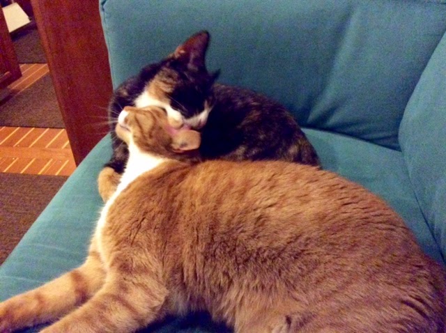
We hugged the eastern shore tightly going in and at mid tide saw no less than 7.8 feet of water during the entry. As soon as we were secured, on 50 feet of chain in eleven feet of water, the rain stopped and the drying process could begin. The cats began their mutual bathing ritual. We were the 17th boat in the lake, with room for more. (Sorry about this font.)
We spent a week in Lake Sylvia in the Spring of 2012 but this time we are planning to stay most of our time in Fort Lauderdale at Cooleys Landing, a municipal marina in the New River, next to Riverwalk and two blocks from Las Olas Boulevard. I guess we are just city people at heart, though we do enjoy nature too, like this Lake Sylvia sunset.


Read More..

May 14 Capital Yacht Club DC to Anchorage North of Bluff Point Colonial Beach VA 56 6 Miles

Two observations: 1. From the last bridge in the ICW in South Norfolk, to Maine -- no bridges that we have to worry about!  2. The Washington Channel is the flying lane for helicopters in the DC area, which has lots of them, apparently to keep them out of the way of the runways of Dulles Intl Airport that are parallel to the Chanel. If you stay at the Capital YC -- get used to their noise!

It was cold the past two nights and yesterday and today. So I was warmly bundled for todays 7:00 to 3:45 passage  -- a retracing of our path, back down the Potomac. The early start was dictated by the desire to capture a few hours of good tide.  We went further than Fairview Beach because we had the time and want to go further tomorrow too. Here is Fairview from the channel, above the gate in the lifelines. It shows that this river is w i d e!
Tide was favorable at the start, giving us, with engine, small jib and wind at our back, about 7.5 knots, gradually diminishing to 4.9 and then building back up to 5.9. Going downstream is faster than going upstream.
With the wind behind us the small jib self-jibes at will while the other two sails, though they would have given us more speed, would have been a bear to handle through all the jibes of the twisty river. In fact the Potomac is a pretty easy river to navigate, especially once you have been there. Our electronic chart plotter displays the water more than 20 feet deep, the channel, in light blue, with dark blue for the shallower water at the sides. Red and green buoys are shown and we generally respect them, but if you stay in the light blue, you cant go wrong.
Tonight the wind is predicted from the south at 5 to 10 knots so while we elected to stop in the Potomac, rather than in a harbor, we are on the north side of a bluff which should make the 5 to 10 knots of wind from the south easy to take tonight. We have 60 feet of snubbed chain in 11 feet of water and no other boats in sight. For those with Google Earth who want to know, we are at 38 degrees, 16.6 minutes North; 076 degrees, 59.4 minutes West. Here:

I have tried to show pictures of things you have not seen before, or new views of the old.  Like this style of buoy. Ive never seen such before. They are common on this river. This one has a guest, or squatter, who is hawking "Danger" as we got too close for his comfort. Check the current running past it-- the "bow wave"
Floridian gargantuan houses on the upper Potomac.
A better view, on a non-foggy day, of the huge power transmission towers with strobe lights.
The rivers banks are lined with such cliffs, as if the Potomac is trying to become the Grand Canyon. It still has a way to go.

Maryland Point Light, with rapids flowing past and many birds watching from the man made islands on both sides.


Tomorrows destination: St. Marys, Maryland.


Read More..

May 6 7 Herring Creek MD to Fairview Beach VA to Washington DC 41 7 and 38 8 Miles

We got underway from herring at 6:40 to avoid low tide a few hours later. There was no wind to speak of. Rivers often provide poor wind though last nights interval of 35 knot gusts cant be denied. So while we had our sails up both days, they gave us only a few tenths and only briefly; it was a motoring day.

We heard what sounded like explosions. I thought it might be coming from our boat but Lene reassured me it was far away, like last nights thunder. Then came a voice: "Sailboat heading north on the Potomac off Cobb Island, this is Range Boat 4." I acknowledged and he asked me to switch to channel 12 which I did. He asked if we had paper or electronic charts and I said "Both". He said they were conducting naval gunnery exercises and the deep wide channel in the center of the river is where the shells would be landing. He asked me to check my charts and pointed out five navigation aids that hug the Maryland shore.  I should thread our way to and through them. We complied cheerfully and while the water was a lot shallower than center channel, it was never less than 12 feet. We heard many explosions, seeming to come in pairs, about two seconds apart: the guns report and the shells explosion upon hitting or its fuse setting it off. This is the orange topped Range Boat One, at the other end of the range, who stopped a crab boat that did not have its radio on.


We passed this nuclear power plant, the smoke or steam rising from it telling the tale of the days wind.


We crossed under the Nice Memorial Bridge on which Route 138 runs.
Once again, with our early start,  we went further than originally planned. The guide books describe anchoring in the Port Tobacco River, which flows into the Potomac from Maryland. It is about four miles wide at its mouth and perhaps four miles deep to the village at its narrow end (approximately the dimensions and triangular shape of Hempstead Harbor in Long Island Sound), but most of it is considerably less than six feet deep though there are large areas on both sides near the mouth that are 7 to 9 feet deep, where we could anchor. With winds (though light) predicted from the South, there would be little protection in those areas. Lene discovered a broad underwater plain on the chart, about ten to eleven feet deep, on the Virginia side of the river, near what the chart described as Fairview Beach, about ten miles further upstream and far outside the channel. This likewise provided no protection from wind or waves -- except from the south.
This place was not listed as an anchorage by the cruising guides, but it was very advantageous in dividing the 80 miles to the District of Columbia into two nearly equal passages. The chart described the bottom as "s sh" meaning sand and shells, which is good for anchoring. I asked friendly Range Boat Four about it. He said he had used it so we did too, and the anchor held so well that we had to use ILENEs engine to break the anchors hold on the bottom once we got its chain tightly straight up; the windlass was not strong enough. We were the only boat anchored and had lots of swing room and potential drag room but the scattered thunderstorms missed us and we had a quiet night. The next day we left at 6:30 to catch favorable tide most of the way, making seven knots instead of four. Again, motoring, except when the engine stopped for a few minutes and I had to switch fuel tanks. We passed this strange and unmarked buoy farm on the Maryland side.


The Potomac is huge - long, broad and deep -
and much of its shorelines are  undeveloped though some nice houses are built on the bluffs overlooking both sides, including this old one -- Mt. Vernon -- George and Martha Washingtons house, to the left of the big white tent, about ten miles from DC.
Except for the crab boat and one other trawler heading south that we passed near the end of our two days, we saw no other boats except for small runabouts and an anchored derelict boat during our almost 80 miles combined, until we got within ten miles of the Nations Capital, where the waterway had ferry traffic.
The Woodrow Wilson Memorial Bridge, which our charts said was a "bascule bridge under construction", caused us some consternation when we first saw it from five miles downstream. Bascule bridges, after the French word for see-saw, are designed to be opened and from the distance it looked low, so we tried to call on channels 16, 9, and 13 to get an opening, but with no response. Lene then read that it requires a twelve hour advance notice for opening. Oh no! She got a telephone number and called. "Yes, but you are in luck, we are opening for maintenance at 11:30 tonight" was the response. Im saying to myself that this cannot be. We will be having a ten hour wait and then have to enter a new harbor in the dark!!  We were told that this new bridge has so much vehicular traffic that it opens only at night. Finally we learned that its vertical clearance, at the white part to the left, which does open, is 70 feet; it is a high bridge that ILENE can pass under without its opening. I had assumed, that all new bridges over major waterways would be at least 65 feet high and many low bascule bridges are being replaced with new high ones so it made no sense to build a low bridge in the 21st century. But it sure looked low from a distance.
We refueled and then docked at the Capital YC, which is under reconstruction, with a series of temporary walkways between the docks leading to its temporary clubhouse in a former motel. We are at the furthest end of the furthest dock, making for a long walk to get out or to the showers, but the most remote dock is a good place for the kitties to roam. We immediately found both the staff and the other boaters here to be quite friendly and helpful. Free coffee, a map with the directions to the supermarket, etc.
Our first afternoon I spent faxing and Fedexing a document to my daughters attorney in Vermont who is helping her sell the riding academy where she has lived and worked for over ten years We also provisioned at a nearby supermarket, washed the topsides and, after dinner aboard, watched a couple of hours of "Wolf Hall" via the Clubs wifi in the clubhouse.
I also contacted my friends, Bob and Maria, who invited us for dinner at their house on Saturday night. I have known them since I worked with Bob in 1970. We last saw at about this time of year in 2006 when they drove to Annapolis to meet up with us there. We are looking forward to spending several sightseeing days in this beautiful city.
Read More..

November 24 27 Fernandina Beach FL to St Marys GA 6 8 N Miles

Yes, there should be an apostrophe in "Marys," on the north bank of the St. Marys River, but there is not. And yes, we have gone north, about three of the 6.8 miles, from Florida into Georgia.
We spent four nights at the end of the west dock of Langs Marina. Many of the boats elected to anchor out in the wide, roomy anchorage, though it is beset by tricky tidal currents and strong winds.
The marina is funky to say the least. Most businesses strive to modernize and offer the best and latest conveniences. But not Langs. The cruisers guides warned us to wear slippers in the shower rooms; they are not cleaned very regularly and are old fashioned. The electric towers into which we plug our thick yellow shore power cables offer electricity at only $3 per night -- if you can get it. Most of the towers, including those near us, do nor work and apparently have not worked for several years. This was inconvenient because it has been cold here and Lene would have liked heat. Help with our lines getting onto the dock? Sure; if your neighbors are about and willing to help.  There are some pretty nice boats here, power and sail, including, across the dock from us, a DeFever trawler operated by the founders and owners of the Active Captain website. But Langs is also home to some boats that look rather derelict. And as you can see in this picture of two felines concentrating intently of the bravest of the remaining birds, guano is not washed form the dock except by the rain.


There are some more beautiful birds here too.


We are about 1000 feet from the street. Another thousand feet brings you to Seagles hotel, saloon and restaurant, where the festivities are held.


Thirty rooms upstairs at $90 to $130 per night.
 Langs is priced appropriately, only $1 per foot per night.
We arrived on Monday and each evening there was more and more shared food with drink getting our stomachs enlarged enough for the major feast at 1 pm on Thursday. There is also a communal check in on VHF radio channel 69 each morning, chaired by Ann of s/v "Sea Tramp". Her husband, Lynn, runs daily or twice a day trips with his van to where ever you may need to go in the area, including the supermarket (Lene went three times!), laundry, pharmacy, dry cleaners, propane refill, eye glass repair shop, etc.
We have been hearing about "Thanksgiving at St. Marys" for years and decided to join in this time. And we are glad we did. Dean and Susan of "Autumn Borne" are known by everyone here, probably because Dean has helped most of them, but they especially befriended us and introduced us to a lot of folks who we will be meeting up with further south in the months and years ahead.
Lene flanked by Dean and Susan and, at the sides, by the crew of s/v "Summerwind". Lets face it: the others here are mostly all retiree snow birds, like us, who come from all over the US, though some of us live aboard year round and others revert to land bases when not cruising. Good folks with a common interest in our boats and in telling each other and listening to each others sea stories. For the feast, the townspeople provided the baked turkey and ham and the cruisers each provided a side dish, salad, stuffing, desert, etc., sufficient to serve ten. But most brought more and this was no hunger game.


For the record, I made blanched string beans with bacon, blue cheese and toasted walnuts, and it got eaten up by the throng.


With the town abutting the back side of the Kings Bay submarine base, the town is postered by these bumper stickers:
Every Day In Camden County Is Military Appreciation Day.


They have a Submarine museum
a block from Seagles, where I spent a few pleasant hours. There I met Mr. Treen, a naval electrician with 18 years of service in the submarine service, currently assigned as base photographer. He was doing a story on the museum.
I got to remembering my six day ride on one of our submarines, the USS Requin (SS-481) As Hammerbergs Anti Submarine Warfare officer, I was exchanged for the Requins weapons officer for the segment of our circumnavigation of South America from Montevideo to Rio in 1966. My biggest thrill: they let me dive the sub. I yelled "Dive!", scrambled down the conning tower as quickly as possible so that others could slam closed and dog down the hatch above my head before water started to flow in and then yelled the command: "Blow negative to the mark!"  This meant to release compressed air into a forward compartment sufficient to give buoyancy to the bow and thus level off the dive. And then the submariners, who knew what they were doing, took over again. I recall the palpable sensation of quiet after we were submerged; the crashing sound of the water while a surface boat slices through it was replaced by utter silence.

Tomorrow, a communal pancake breakfast (yes more food!!), a swap meet and then we plan to go east and a bit north to an anchorage off Cumberland Island National Park for a few days before resuming southward from the St. Marys area.
Read More..

December 14 15 New Smyrna Beach to Titusville and First of Three Lay Days There With Car 35 Miles

Motoring in the ICW is not a peak experience. During this trip and while at Titusville, there was almost no wind. It was sunny and not as cold. I put up a head sail for about an hour but then the wind was gone again. Companions make it more interesting. These guys, from New England, said that they were in training for the spring racing season and wanted to be on our "wake". They kept up with us, motoring at 5.7 knots, for about half an hour before turning back. They said "Were your dolphins!"
We also saw more dolphins than ever before, in small and large pods, close to a hundred total, during the five hours we were underway.
In Titusville one simply takes an available mooring and then calls the Marina to tell them the number. The Indian River is as much as three miles wide but with a depth of only one to six feet, except for the ICW channel with twelve feet depth that is perhaps 50 yards wide. Near Titusville the river has a piece that is seven or eight feet deep and several hundred yards wide. This is the anchorage and mooring field. We took a mooring near the ICW and near the outer end of the private marked channel leading from the ICW to a large marina with many slips that was dredged in the western (mainland) side of the River. The chart showed three low bridges, one shortly before we arrived and two further south. The first is for a railroad and is apparently open unless a train comes. The second was replaced by a beautiful new high expensive bridge, shown here from ILENE at sunrise,
and so only the third requires us to request an opening. I think they made a mistake in deciding which of the two car bridges to replace: the high one leads to the Merritt Island National Wildlife Refuge and is little trafficked. The remaining low automobile bridge also leads to the Kennedy National Space Center at Cape Canaveral and has a lot of cars and buses to be detained. Id be interested in what local politics caused the decision to replace the wrong bridge.
We took both our dinghy lights (so others can see us) and our flashlight (so we could see the unlighted channel markers and find our way home after dark). We had some wine on Autumn Borne with Dean and Susan. They are planning to haul, do their bottom and visit relatives back in Buffalo and will catch up with us later on. Also aboard were the crew of Seeker, Earl and Kathy, and friends who sail but live in Florida and did not have their boat here: Eric, an engineering colleague of Dean, and Joyce, a biker and tennis player, from Holland. When Erik and Joyce had to leave, the rest of us had dinner at Crackerjack, by the foot of that new bridge.
Next day was the first of our three with a rental car. After breakfast out we went to the Kennedy Space Center. We took the bus ride out along the path that the mammoth mover travels carrying the rockets (at one mph), and saw about four videos, each in its own theater, walked through a lot of objects, large and small and heard a great talk by former astronaut Don Thomas, who made four shuttle flights, the highlight of the day, actually.
Each stripe in the flag is eight feet wide!
Lift off!
End of Stage Two, with me, below, to give a sense of scale
Lene by capsule, looking lovely, as usual
.
The Rocket Garden
We were there from 10 to 4 and were quite tired by the end of it. We have access to a movie house here and Interstellar was playing but no, a quiet evening aboard.
The Space Center is operated entirely without government support, it brags: But taxpayers pay for it. Driving there for two seniors includes a $10 parking fee and $97.00 admission. it was not as expensive 25 years ago when I was here last.
Read More..