Tampilkan postingan dengan label 7. Tampilkan semua postingan

April 21 22 Charleston SC to Wrightsville Beach NC 155 7 Miles

We left at 10 as planned, but I screwed up reading the tide table so the tide was against us on the way out of Charleston, though weakly. We put up the main in the inner harbor and jibed it several times on the way out, past Fort Sumter where our Civil War began. Actually it began in SC, earlier, with the thinking of Calhoun, on the theory of states rights to "nullify" federal authority, a doctrine now becoming popular again among the lunatic right in this country.
We turned left as soon as we reached the first buoy after the end of the seawall and put up the genoa as well. This was before noon but the wind was too weak and too far behind us, to move the boat with  any speed, so we motor sailed, mostly motored, until about 1:30. I even had taken down the mainsail. I had not realized how much of the first 109 mile long part of this passage, was more easterly than northerly and so the projected five to ten knots of west wind was behind us. Then came wind, much stronger than projected and a gift to us. I was able to get up half the mainsail, with double reef in it, and continued with the genoa. The wind built behind us and we were screaming along at seven to eight knots with peaks at 8.9. And with the wind about 120 to 150 degrees from our bow, we rolled a lot from side to side, most unpleasant. Lene felt a bit nauseous though she did not lose her food. We had a delicious cold dinner -- no cooking with the rolling. It was warm and sunny by day and reasonably warm at night, with no rain. But during the night we got some slow speeds, less than four knots and even though I did not put up the genoa again until near daybreak, it was this night part, as well as the first few hours, where we lost time
After dinner, at 7:30, we replaced the genoa with the small jib, a safety measure for nightime sailing in big waves, and were still making over seven knots with just the small headsail and double reefed main. We had put on the preventer to prevent accidental jibe of the mainsail, and with the small jib sliding back and forth we took it in and sailed under just double reefed main. The preventer was a good thing because the wind had shifted from off our starboard quarter, to off the port quarter during Lenes watch. We were sailing "by the lee" -- the way you get that accidental jibe. When I got up at one (Lene let me sleep late) we jibed the main and continued on toward the turning point - off the tip of Frying Pan Shoals, which extend many miles out into the Atlantic from the Cape Fear River. We saw very little traffic: Two big freighters passed us at quite respectable distances -- closest point of approach being miles away -- and one sailboat overtook us, headed for Beaufort. I saw his lights and estimate he was 200 yards off our starboard side, moving a fraction of a knot faster than ILENE. Prior to the close passage I had a radio conversation with him to confirm what each of us was going to do.
Once around Frying Pan, at about 4 to 5 am, we turned north to Wrightsville (The Masonboro Inlet) and the wind came up from our port quarter to its beam and even forward of that. This second leg was only 32 miles and wind speed varied considerably during the leg, as, consequently, did boat speed.
It is hard to get good pictures of a night passage so at least I have the long awaited dawn.
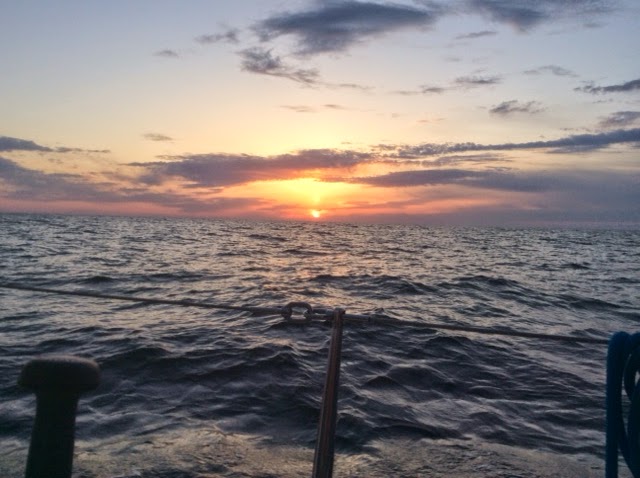
Masonboro Inlet is easy, wide, well marked and flanked with seawalls. Once in, it is easy to get to the anchorage area and we dropped at 1:30, only 90 minutes "late" compared to our projected schedule that would have averaged 6.5 knots. Nice homes line the bay side of the barrier island.
We put out a lot of chain because there is lots of room and 20 knots were predicted for this evening. But by 4 pm it was howling at up to 40. We visited Wrightsville and made the reciprocal of this same ocean passage, to Charleston on our way south last fall and hence felt no need to lower and raise the dink to stretch our legs in Wrightsville. Tomorrow: Beaufort NC, about 80 miles and if the forecast comes true, a beam reach  or close reach from the port side, with five to fifteen knots.
I  tried to take a photo of the pod of dolphins playing under and around our bow, taking the Ipad up there, but they are way faster than ILENE at eight knots. I took maybe 50 shots and only one, a video of less than one second, caught a dolphin. These were not the slow graceful swimmers in the ICW but racers amidst the big ocean waves. I couldnt get the video into this post but it is on Facebook. I did manage to neither fall off the boat nor drop the camera.
Ilene is a true member of this crew and a solid citizen on overnight passages. She grumbles a bit and still relies on me, and I have to admit I like the  second part of that. She is even taking an interest in the charts, tides and weather. I couldnt make this trip without her, physically, mentally or emotionally. We have some chores that each of us do most of, but both of us do many of the chores. She said she liked our 25.5 hours together.
On our honeymoon on the old ILENE, in August 2002, we spent a pretty terrible 36 hours in a noreaster off the coast of Maine  The boat got beat up (torn sail, water inside through the dorades, compass light out) and we got beat up too. After a good nights sleep Lene asked, "Where do we go next?"  I replied "God, I married the right woman!"  And that has become truer with each passing year.
Read More..

HYC Cruise Day 7 July 31 Second Lay Day in Block Island


Shanghai departed after the fog lifted and CJ reported that they made it to a mooring in South Cove at old Saybrook in the Connecticut River.
True North rested up after Bruce felt ill from the dinner the night before. The folks on Blast continued exploring this island via automobile and planned dinner at Deadeye Dicks.

We detached and stowed Ohanas dink engine and then hauled the dink aboard and discovered the cause of the leak when water that had entered the inflatables starboard tube flowed out through a separation between that tube and the blue conical cap at its aft end. Drained of air and water it is rolled and stowed with the outboard.

Ohana and ILENE then took advantage of our rafted condition to take a 4.5 hour day sail past the southern coast of the island aboard Ohana, leaving ILENE on the mooring. We experienced moderate winds under clear sunny skies accompanied by big ocean rollers from yesterdays winds. We saw Mohegan Bluff and the SE lighthouse from the sea, from a distance.
Our fastest speed was sailing back into the Great Salt Pond.

After our return, Rolo, Laura and Christain headed off to swim and dinner while Lene, Bennett and Roger dined at Elis, a small gem of a restaurant one block back from the main road through the Old Town. Elis is a fine dining experience that Ken and Camille, who plan incidentally to meet up with us in Stonington CT, tomorrow,  introduced us to a few years ago. This was my third time there and we have never been disappointed. It opens at six, takes no reservations, does not advertise and is always full. I got there early and  waited on line while Lene and Bennett shopped for souvenirs. Im not going to describe the menu but it is imaginative and if we paid a lot more for this food in Manhattan we would not be dissatisfied. And the walk back to the Boat Basin helped the food settle.
Read More..

May 6 7 Herring Creek MD to Fairview Beach VA to Washington DC 41 7 and 38 8 Miles

We got underway from herring at 6:40 to avoid low tide a few hours later. There was no wind to speak of. Rivers often provide poor wind though last nights interval of 35 knot gusts cant be denied. So while we had our sails up both days, they gave us only a few tenths and only briefly; it was a motoring day.

We heard what sounded like explosions. I thought it might be coming from our boat but Lene reassured me it was far away, like last nights thunder. Then came a voice: "Sailboat heading north on the Potomac off Cobb Island, this is Range Boat 4." I acknowledged and he asked me to switch to channel 12 which I did. He asked if we had paper or electronic charts and I said "Both". He said they were conducting naval gunnery exercises and the deep wide channel in the center of the river is where the shells would be landing. He asked me to check my charts and pointed out five navigation aids that hug the Maryland shore.  I should thread our way to and through them. We complied cheerfully and while the water was a lot shallower than center channel, it was never less than 12 feet. We heard many explosions, seeming to come in pairs, about two seconds apart: the guns report and the shells explosion upon hitting or its fuse setting it off. This is the orange topped Range Boat One, at the other end of the range, who stopped a crab boat that did not have its radio on.


We passed this nuclear power plant, the smoke or steam rising from it telling the tale of the days wind.


We crossed under the Nice Memorial Bridge on which Route 138 runs.
Once again, with our early start,  we went further than originally planned. The guide books describe anchoring in the Port Tobacco River, which flows into the Potomac from Maryland. It is about four miles wide at its mouth and perhaps four miles deep to the village at its narrow end (approximately the dimensions and triangular shape of Hempstead Harbor in Long Island Sound), but most of it is considerably less than six feet deep though there are large areas on both sides near the mouth that are 7 to 9 feet deep, where we could anchor. With winds (though light) predicted from the South, there would be little protection in those areas. Lene discovered a broad underwater plain on the chart, about ten to eleven feet deep, on the Virginia side of the river, near what the chart described as Fairview Beach, about ten miles further upstream and far outside the channel. This likewise provided no protection from wind or waves -- except from the south.
This place was not listed as an anchorage by the cruising guides, but it was very advantageous in dividing the 80 miles to the District of Columbia into two nearly equal passages. The chart described the bottom as "s sh" meaning sand and shells, which is good for anchoring. I asked friendly Range Boat Four about it. He said he had used it so we did too, and the anchor held so well that we had to use ILENEs engine to break the anchors hold on the bottom once we got its chain tightly straight up; the windlass was not strong enough. We were the only boat anchored and had lots of swing room and potential drag room but the scattered thunderstorms missed us and we had a quiet night. The next day we left at 6:30 to catch favorable tide most of the way, making seven knots instead of four. Again, motoring, except when the engine stopped for a few minutes and I had to switch fuel tanks. We passed this strange and unmarked buoy farm on the Maryland side.


The Potomac is huge - long, broad and deep -
and much of its shorelines are  undeveloped though some nice houses are built on the bluffs overlooking both sides, including this old one -- Mt. Vernon -- George and Martha Washingtons house, to the left of the big white tent, about ten miles from DC.
Except for the crab boat and one other trawler heading south that we passed near the end of our two days, we saw no other boats except for small runabouts and an anchored derelict boat during our almost 80 miles combined, until we got within ten miles of the Nations Capital, where the waterway had ferry traffic.
The Woodrow Wilson Memorial Bridge, which our charts said was a "bascule bridge under construction", caused us some consternation when we first saw it from five miles downstream. Bascule bridges, after the French word for see-saw, are designed to be opened and from the distance it looked low, so we tried to call on channels 16, 9, and 13 to get an opening, but with no response. Lene then read that it requires a twelve hour advance notice for opening. Oh no! She got a telephone number and called. "Yes, but you are in luck, we are opening for maintenance at 11:30 tonight" was the response. Im saying to myself that this cannot be. We will be having a ten hour wait and then have to enter a new harbor in the dark!!  We were told that this new bridge has so much vehicular traffic that it opens only at night. Finally we learned that its vertical clearance, at the white part to the left, which does open, is 70 feet; it is a high bridge that ILENE can pass under without its opening. I had assumed, that all new bridges over major waterways would be at least 65 feet high and many low bascule bridges are being replaced with new high ones so it made no sense to build a low bridge in the 21st century. But it sure looked low from a distance.
We refueled and then docked at the Capital YC, which is under reconstruction, with a series of temporary walkways between the docks leading to its temporary clubhouse in a former motel. We are at the furthest end of the furthest dock, making for a long walk to get out or to the showers, but the most remote dock is a good place for the kitties to roam. We immediately found both the staff and the other boaters here to be quite friendly and helpful. Free coffee, a map with the directions to the supermarket, etc.
Our first afternoon I spent faxing and Fedexing a document to my daughters attorney in Vermont who is helping her sell the riding academy where she has lived and worked for over ten years We also provisioned at a nearby supermarket, washed the topsides and, after dinner aboard, watched a couple of hours of "Wolf Hall" via the Clubs wifi in the clubhouse.
I also contacted my friends, Bob and Maria, who invited us for dinner at their house on Saturday night. I have known them since I worked with Bob in 1970. We last saw at about this time of year in 2006 when they drove to Annapolis to meet up with us there. We are looking forward to spending several sightseeing days in this beautiful city.
Read More..

November 15 to December 7 Mostly About The Anchor Chain and Next Summer

Four trips to the boat but only eleven hours work, scraping rust off the anchor chain. It is hard work with a stiff paint scraper and I cut myself one day after which I wore heavy work gloves. The problem is that it takes almost an hour to do a foot of chain and and ILENE has 300 feet, over 100 feet of which are heavily rusted. The guys at the yard told me to buy new chain but I priced it at about $1300 plus tax and shipping. Wow. Keep scraping, Roger! Here are
rusted links draped over my denim clad knee, with "cleaned" links in the upper right. But another guy in the yard suggested a "hot dip" regalvanizing process that can be done by a firm in Jersey City. I checked it out and they will do the job for $350, first using acid to remove the rust and then dipping the chain in  molten zinc to get a good solid coating of it on the chain. So no more scraping for me.
I attended the Interim Board Meeting at the Harlem; a nice dinner as a way  the Club rewards its hard workers with good fellowship and a good meal "on the house!" And they gave out fire-engine-red fleece vests with the Clubs logo. I felt a bit guilty because as outgoing Fleet Captain I did not do much work for the Club in 2015.  I have been searching out a locale for our annual dead-of-winter outing, to take place in February.  Another scraping day was followed by a good brunch at the Club before a visit to the City Island Maritime Museum.  Its collection has evolved a bit in the last couple of years but the highlight was a lecture by the unofficial"Official Historian" of City Island, who is a sail maker by profession. His knowledge of the numerous businesses, their owners and craftsmen and the boats that were built here over the past couple of hundred years is intense, with slides to illustrate most of it. Big names in the history of boat building and sail making worked here. I met two couples of Harlemites and there were about a dozen Corinthians, who invited me to join them for dinner after the lecture. But after brunch and refreshments at the museum, I went straight home and had an apple for dinner.
I renewed my Corinthians membership and signed up for their one week cruise in the Mt. Desert Island region of Maine next July and August. I also joined the Seven Seas Cruising Association, after Bob, of Pandora, had encouraged me to do so for years. It appears that Im eligible for "Commodore" status based on the mileage I have logged off shore and the time spent aboard, but the third requirement for that status is that one be a member in the lesser class for a year. They do a lot of information sharing and I responded to two requests for information, about Angelfish Passage through the Florida Keys and about sailing in Turks and Caicos. I simply referred the questioners to the relevant posts in this blog. And I have spent some time trying to get the Nova Scotia portion of next summers vacation organized. I asked the other members of the SSCA to share their experiences with me and called Landfall Navigation, an excellent chandlery in Stamford CT, who sent me information on the relevant paper charts, published by the Canadian government, that we will need, and cruising guides. And I selected the right electronic chart, but I will not buy charts until next spring; you want them to be as up to date as possible. And I contacted Fernando, who did stainless steel and fiberglass work two winters ago, to get him lined up to repaint the blue boot stripe when it gets warm enough next spring. So work is continuing apace.
Read More..

April 25 26 Beaufort to River Dunes Marina Oriental NC and Lay Day There 28 7 Miles

At 8:10, we had help from the Beaufort Docks staff  "springing" us off the docks so our stern was swung out and we could back out safely. (They hold a line from our stern on the end of the dock while we go in reverse while trying to steer out. It works!)  This was the time of my choosing, but about 10 minutes too soon, resulting in a wait of that duration for the 8:30 opening of the Beaufort Bascule Bridge.
Once clear of the bridge we went perhaps a hundred fifty yards and then aground in mud. There is a fork in the watery path, of which we have to take the right because the left fork was silted in years ago. Mindful of that, I was so vigilant to to not take the right that I took a left, but at  earlier fork, and into a channel that was too shallow for ILENE at low tide. It was low tide so I knew we would float off eventually. But after half an hour I tried another trick. I swung the boom far out to starboard and hung my weight way over the side of the boat to heel her, just a few degrees, to break the contact of the keel with the mud, while Lene gunned the diesel. We were off again, delayed by half an hour, but no worse for wear. It seems I make more mistakes first thing in the morning. This is something to watch out for.
From then on, the only problem was the tide which slowed our progress up the Beaufort River, and through Adams Creek. With low tide at Beaufort at about 9, I thought we would have the help of a flooding tide pushing us on our way up. No such luck. About ten miles up is a high bridge and there the low was at 10:30. I put up the small jib but furled it soon, when it was obvious that there was NO apparent wind to breathe life into it. Even in the broad Neuse River, which we beat down in 2012, there was no wind. Our depth sounder stopped working for about ten minutes but then came back to life while entering River Dunes off Broad Creek. This place was dredged out of the pine forests since our chart was published and has about 160 docks constructed, less than half the number when it is fully built out. They try to make it feel like a Yacht Club, with its own Burgee and Clubhouse with library.


ILENE is at extreme right

We took on a load of fuel at their fuel dock at 3:30, having motored a lot since Jekyll Island, and got on our dock at 4:00.  The rain which had looked threatening all day, held off until the evening and night and during our lay day.
I washed the topsides, cleaned off the rust stains leading from the anchor chain down the outer edge of the starboard side of the deck, where the salt water washdown pump washes the rust particles it takes off the anchor chain, and then waxed this strip to try to keep the rust out in the near future. One shouldnt wax the nonskid deck; it is made rough on purpose. But this narrow strip is now waxed and I have to be careful to tell Lene not to place her feet at the outer edge.
We met some interesting people on our neighboring boats, including a Canadian man on a Catalina 42 with a 185 pound Pyrenese. We dined at the River Dunes Clubhouses dining room, only serving ten dinners that night, in addition to those for a wedding party above. Good food here.
On our day day we were picked up by Bill and Sandy, and served a delicious brunch of baked french toast with ALL the trimmings in their home, with its commanding view of the Neuse. They picked us up at 9 and brought us back at 2:30, so we had a good long time for discussing boats, destinations, books, politics, families, etc.
River Dunes is a relatively new marina, with good wifi and showers. They have an exercise room, pool and sauna. It is very well maintained, only $1.50 per foot and we cashed in the one-time-only Annapolis Boat Show special offer of two nights for the price of one. We liked it here when we visited at about this time of year in 2012 and just as much this time. We hope Bill and Sandy will visit us in NY, perhaps on their way on the loop around eastern Canada aboard m/v Lucille. From NY they would go north on the Hudson, through the Erie Canal, into the Great Lakes, east through the Thousand Islands, down the St. Lawrence River and, after Nova Scotia and Maine, back to North Carolina.
Read More..

Rhode River to Cambridge and Three Lay Days in Cambridge October 13 17 38 7 Miles

First the passage: The wind was predicted at 5 knots, building to 15, in our face. Not pleasant, but manageable. It came from the predicted direction, a bit east of south, but at  20 to 25 knots and one has to add five to that to account for our boats speed into it!  And with Chesapeake Bay running generally north-south, the wind had time to work up large stiff waves of up to five feet. ILENE was pitching in these waves, some of them breaking over her bow, throwing spray back onto us. And with both these waves and the wind pushing us backwards, we were making only about four knots over the ground -- making for a long day to cover the 34 miles involved.

What to do. We changed course by 35 degrees, with the engine still working at its high speed for continuous use, 2500 rpms, and put out the small jib. Now less pitching, speed up to over six knots and a whole lot of heeling. The Saga owners network is having a discussion of the merits of adding  a ton of extra lead at the bottom of the keel (a sole under the keels foot as it were) and with Lene reporting this was on her "ten worst passages" list, I think the time has finally come to bite the financial bullet and do this -- next winter, when the boat is hauled. I thought of taking photos for you, or video, which could have shown the excitement, but decided to keep the salt water off the iPad, which was in a ziplock bag.

Turning a bit east, into the Choptank River, the wind was 60 to 80 degrees off the starboard bow and our speed was over seven knots with the throttle turned way down.  But this wide but shallow river twists and turns and when we came to a point where tacking in the channel would have been required we elected to furl the small sail and motor the rest of the way.  The trip took seven hours, from 11 to 6.

The landing at a dock in the Cambridge YC was very poor due to Captain Roger forgetting an important rule: always check the wind direction when attempting a landing at a dock. Maybe I was tired -- a reason but not an excuse. Anyway, the wind blew us onto the dock. We should have aimed further away from the dock, stopped and let the wind blow us to the Tee dock. Instead, with some way still on, we crashed our starboard quarter with the dinghy, hanging from its davits athwart the stern and protruding a few inches out past the side of the boat on each side, catching the dinks bow on one of the pilings that support the fixed height dock.  The painter, which is one of three lines used to snug the dinghy to the boat, parted (here reattached and a foot shorter),
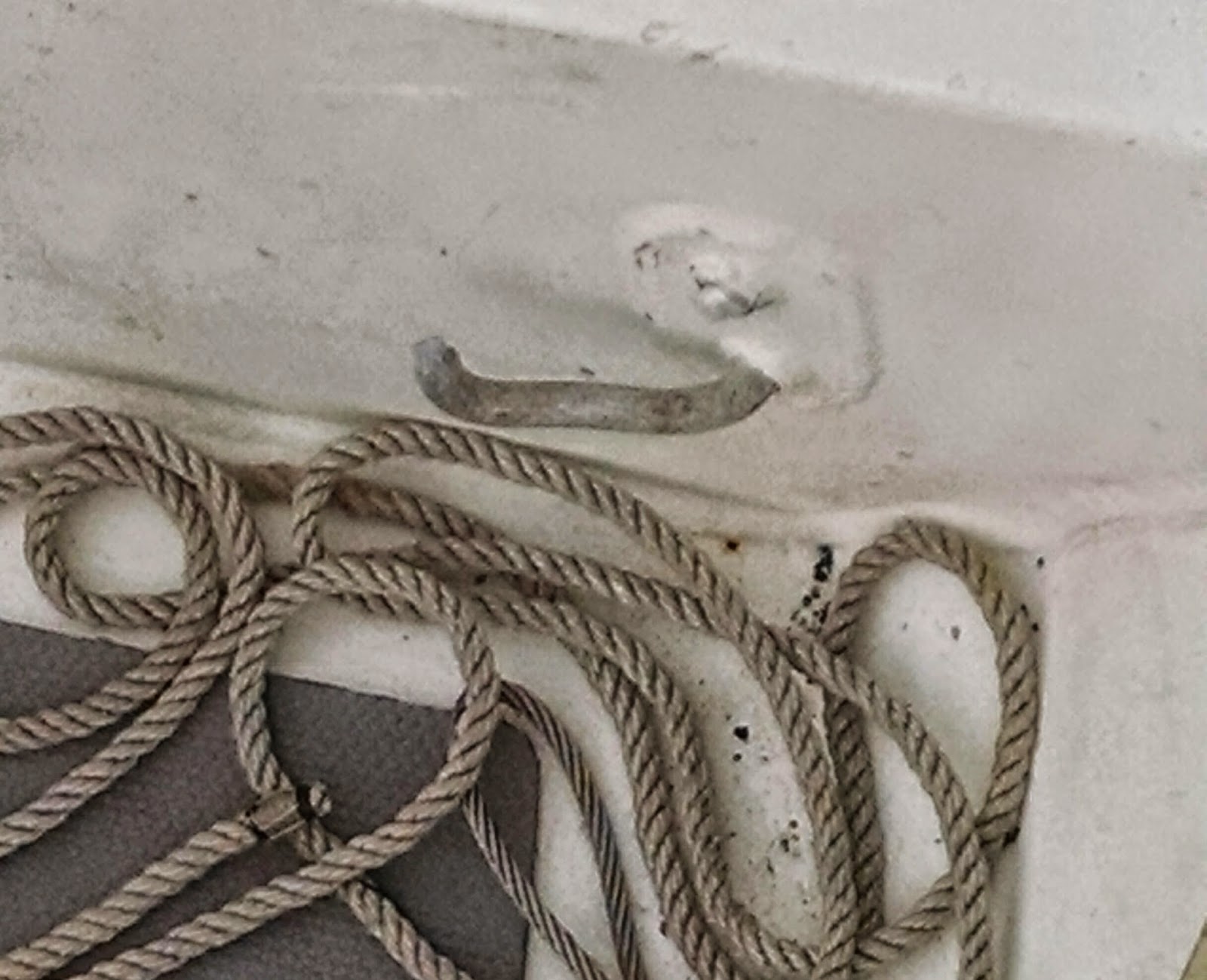
and one of the welded aluminum


 padeyes holding up the bow ripped open.
But we landed and enjoyed three days at the YC, though the first of them was rainy.


On the sunny days that followed we enjoyed this view from ILENE of a replica of a screwpile lighthouse at the adjacent marina. I visited our friend, Johns meticulously maintained 28 foot S2, "Hearts Content" there.
 John, a former New Yorker and Harlemite was the best host one could find and our reason for staying in Cambridge. He has many talents in boating and as a mechanic, and he has a whole lot of power tools and the knowledge of how to use them. He rebuilt the interiors of the Plaza hotel and Columbia Universitys Butler Library as well as working for 15 years in NY theater, both on the stage and behind it. A gentleman and a pleasure to be with who put himself at our service. 
He drove us all around the town (population 12,250) showing us where everything was, took us to the post office to mail time sensitive mail, to the hardware store where we got a stainless steel padeye, bolts split washers, to the supermarket, several times, for provisions, to his home where we hacked off the extra length of the 1/2" bolts of the padeye and chamfered the edges, did our laundry and printed out a letter that was on our computer. He lent us one of his cars. He came to the boat and "helped" (lets just say he did the jobs with me as helper/learner/doer of the easy parts). He ground off the remnants of the old aluminum padeye, drilled the 1/2 inch holes for the new bolts
and we attached the new stainless padeye -- stronger than before!
We also replaced the old carburetor with the new one which had been fedexed to his house and he showed me how to adjust the idle and it works again!


We spent our days here with John and actually stayed the fourth night, when it was much calmer, at the wall of the town basin, rent free.
For our stay in the basin, he suggested the creation of the fender board, shown here, which uses two fenders and a hanging board to keep the pilings from harming the boat.
We watched Johns TV. He took us to his favorite restaurants and bar, Leaky Petes, where we had Natty Bos (National Bohemian beer). We tried scrapple, and crab, oyster and fish.


Cambridge is a very sleepy town, which has seen better times, especially its downtown district, which was devastated by suburban stores, fires, the recession and greed. We toured its Arts Center, and visited its Maritime Museum
and the Harriet Tubman Museum, but  the last two were closed.


Here are the kitties exploring a neighboring boat at the YC; maybe they smelled fish.
And I just loved this one, which I call "Still Life with Boat".

On our last day John took us on a long car ride to the southernmost of the three Hoopers Islands, connected by road and only a few feet above sea level, and populated mostly by watermen (crab and oyster harvesters) and their families. These islands were reached after driving through the Blackwater Wildlife Preserve, a huge swampy expanse.  We had lunch at Old Saltys

which has this wonderful view of mainland Maryland, the thin line at the horizon, across the Bay,
where we will be going next. John and I are planning the next leg of the cruise, I wish we could have persuaded him to come along for a few days.
Read More..

Leading Up To The Departure Sept 22 to October 7

Time to say goodbye to the Harlems mascots -- though these birds can get nasty when not given what they want. They come every summer. The white ones are the parents, and the darker ones were born this year and are full size but not yet white. God willing, they will return to the Harlem in 2015 before we do.

During the period of this post I had only three sails totaling only eight hours and all in light to nonexistent winds. One of these was aboard ILENE, with Stu and Barbara. Stu is a Past Commodore and they recently sold their power boat so, being boatless, I was able to seduce them to sail with me. We went to the fuel dock in Port Washington to fuel up, round trip about six or eight miles, and it took us four hours of pleasant conversation, with a delicious lunch, except we motored half of the way.

I had planned to participate in the Harlems annual Take Veterans Sailing Day, and with Ilene away had slept aboard in anticipation of that event the next day. But the engine would not start, probably because I had burned up all of the four gallons of fuel in the starboard fill fuel tank in the process of removing the final water from that tank. Howard, in his mid eighties and very intelligent and spry, helped me "bleed" the air out of the system and change the Yanmar fuel filter, which had a bit of water in it and no fuel. Howard had spent a harrowing, storm tossed ill fated week aboard ILENE in the fall of 2010 during which major damage was done, which will be the subject of a post some day when I have no current news to report. Yet Howard was willing to sail with me again! We sailed his 28.5 foot Hunter, "Covered Call" for a few hours, and because both of us are veterans, we "sort of" fulfilled the mission of the day, though all of the American Legionnaires, our Clubs actual guests, had been taken out aboard other boats by then. The boat moved very well in light air and was a pleasure to sail. I was able to better attach the tack of her genoa and pull it closer to the furling foil to give that sail a better shape using bits of light line that Howard had aboard.

The third and final sail of this period was on "Jazzsail" with Lloyd and Rhoda. I had a good time working most of the time aboard whipping the ends of their lines.

As contrasted to the three brief sails and two days with overnight sleep aboards, there were six work days (totaling only 23.5 hours), including two with Ilene as helper. Her forte is organizing and things are now put away. Hopefully I will be able to find them! We loaded a lot of stuff aboard, cleaned inside and out, took her to the dock to fill water tanks, readjusted the davit bar, finally figured out a way to add air to the dink (using the old foot pump from the prior dink with the nozzle of the current dinks pump) and did miscellaneous bits of electrical, carpentry and marlinspike work including rigging a true preventer (of accidental gybes) system.

As of October 7, the last day of ILENEs "first season" of 2014, I have 66 "Work" days, and 27 "Other" days but only 50 "Sailing" days (on which I sailed and/or slept aboard). But during our second season, October 8 through December 31, God willing, we will add 85 more sailing days, bringing 2014s total sailing days to 135.

Key West, Here we come! Im psyched!!


Read More..

May 19 22 Solomons to St Michaels and Three Lay Day There 50 7 Miles

Underway 9:30 to 5:45.  Winds "light and variable" said NOAA. And they were directly from the north until noon when we put up the rags as our course came to 020 and we were on a starboard close hauled reach which broadened. We passed some interesting sights. Cove Point Light disproved my prior assertion that there are no pretty lights in the Chesapeake.
Night passages require you to keep in the center to avoid unlighted fish weirs like this one, quite a ways off shore.
  This is part of a dock for the off loading of liquid natural gas into tanks ashore.
A voice on VHF told a boat passing closer than a quarter mile to keep off - security zone.
For about an hour we sailed without the engine, at about four knots; light and variable. Back to engine when our speed got down to two knots. Lene heard something funny and reported that no water was coming out of the salt water cooling exhaust, so we quickly turned the engine off and continued slowly under sail. I checked the intake of seawater into the boat and it was not clogged. So we tried again and either we had not had a problem in the first place or it went away spontaneously. Warm seawater spurted out of the exhaust, again.
Our friends, Mike and Janet, ex Harlemites whose lovely home we visited in Ft. Pierce, FL, have their summer home here. Janet scouted out the anchorages, which get crowded on beautiful summer weekends. In 2006 we came here twice and docked once at the marina and once in the Maritime Museum. But it was Tuesday and before Memorial Day, and there were no other boats on anchor so we came into the small inner harbor, in eleven feet of water on 65 feet of snubbed chain. This was preferable to the large but exposed anchorage out in the river where it is about 18 feet deep. Our private cove.


Lene looks happy after the passage, her last of this winter, and her smile makes her look great, but then again she always looks great.
During the night the wind came up and either we dragged a bit or our rode got stretched out straight in a different direction. Either way, we appeared closer to the land behind us so we picked up and reanchored.
We dinked in to the public dock and bought groceries at Acme. I got both a postcard and an outfit for my granddaughter when we toured some of the local shops. Returning to land after lunch, we were picked up by Mike, driven around town and to their great home where we hung and talked about old times.
Later we enjoyed dinner with them at the Miles River YC. Yum. A very nice club with an active racing program including Star class boats that are stored ashore and winched down into the water for races. They also race dugouts which are very old fashioned wooden boats with three sails. Their interesting quality is that in lieu of a keel, they use people, as many as four per board, as many as four boards, tucked under the lee gunnel and extending about ten feet out the other side. There crew members are human ballast, leveraged to keep the boats upright. In the Chesapeake Bay Maritime Museum they show a video of these races. Wild! The same sort of idea are raced in Geogetown in the Exumas, Bahamas.
It was the next day, after we had sweet potato mango pancakes at Mike and Janets house, that I visited the museum, seen here from the dink tied to ILENE, with its screwpile lighthouse.
First thing a saw was this T-shirt, which I did not buy.
It further gives the lie to my prior assertion that none of the Chesapeake lighthouses are pretty. It was raining all day.

Another boat came in while Lene was aboard and I was in the museum, and anchored near us. Pretty close but not two close, seen here at sunrise the next day. During our last night, three others crowded in as well.
I spent some time talking with the volunteers who build and repair wooden small craft in the museums boathouse. I learned how they make round masts and spars: they start with a square log and plane off its four corners resulting in an octagonal one. Next step makes it a sixteen sided and then 32 sided, which appears round, but it is sanded with paper stretched across a frame so it has a rounded surface. Neat tricks.
The center of the museum is an exhibit on the myriad ways that folks have used the water of the Bay: as a livelihood, for pleasure as housing and the myriad variations of boat racing, yacht clubs, camps, fishing, etc.

 One three-tree "canoe" exhibited in the boat shed was placarded as having a beam of 62. No way was it that wide; I told the museum people.
Mike and Janet lent us their car on our last day and we drove for sightseeing in nearby Easton and visited its art museum. There we met John and did some provisioning.  John drove back with us in his car in preparation for his voyages for the rest of this cruise, from here back to NYC. This gave Lene the opportunity to drive his car to NY and park it at the Club so John and I will be able to offload perishables and necessaries back to our apartment and he will have wheels to get home to Cambridge MD. This also means that Lene avoided the NYC - Chesapeake passages on both ends of this cruise.
We had planned only one lay day in St. Michaels, two in the Wye River, which we loved in 2006, and two in Annapolis, before the start of the passages home. An all day rain killed off the Wye River and Johns schedule made it better for all us to leave from St. Michaels for home. It seems that plan B usually wins out over plan A.

Read More..

January 20 Pumpkin Key to Rodriguez Key 27 7 miles

It worked like clockwork. The alarm got us up at 6:30 and after coffee we were underway at 6:50 and Angelfish, which we feared, was easy; no soundings of less than 8.2 feet. We were through it by 7:50.
The tide flowed strongly against us in the Creek, with surface eddys swirling, as in the East River back home, and the wind in our faces, both of which slowed us down, which is good if you fear a grounding. So you can chalk us up in the group that holds that Angelfish is doable in a 5 8" draft hull. (High tide was at 8:10.)

Once out in Hawk Channel the depths were in the teens and we ran under Genoa alone at speeds of up to 7.5 knots with the wind a bit forward of the port beam. Yes, we actually got to sail!!!  Yesterday and today we were greeted by dolphins again after a long absence from them in Dade County. Hawk Channel is wide and marked by buoys.

We were anchored behind Rodriguez Key by 11:30 am.  The key is a big uninhabited, wooded oval l.8 miles long and 1/4 mile wide, which lays east to west. It is a nature preserve, girded by mangroves, with no apparent means to reach it by land, sea or air. On its north side, between it and Key Largo there is room for a hundred boats to anchor in 7 to 9 feet of water. We were the only boat here when we arrived, later joined by eight others. The winds were from the SE and hence the key provided little protection from them or the waves they kick up, but mild winds were predicted for the evening and night.

We were here so early that I wondered if one could tie up a dinghy on Key Largo (Spanish for Long Island?), a mile away. Yes, but only by the payment of $20! My curiosity to explore a bit of Key Largo was not that strong. We also thought to play with the SUP which has not been used since we rented it back in Miami Beach. But the day was not pleasant, cool, grey over head and showers predicted, so we did not do that either. And not many chores -- a low tie of the genoa to its roller furler was redone, as was the lower tie of Old Glory to her staff. The hose from the gas tank to the outboard now works again. I am so lazy these days. reading, writing and laying around. Is it possible that Im slowing down?

Read More..

November 7 Morehead City to Swansboro 20 4 miles

We headed off in the ICW through Bogue Sound and this is hard work because the sound is so wide and the deep channel so narrow. I ran us into the sand at one point but we dropped the sail and backed off. Yes, I tried to sail, using the small jib only, which gave us an extra knot or two, but the strong gusty wind blew us off the course auto pilot was trying to steer; and with trimming the sail came the inattention that led to the grounding.  So no more sailing today. 
We were underway from 9:30 to 1:30. Most of the way was a few degrees north or south of due west. Ilene called the Coast Guard who told us that the live shelling at Camp Lejeune would end at noon, hours before our arrival, so we could anchor at Mile Hammock Bay. But just a half mile after we passed Swansboro, “Pipe Dream,” which has overtaken us, was coming back the other way and told us that the live firing would continue until 5, too late for us to arrive there. So we too did a “U” turn and anchored in Swansboro.
The pencil is pointing to the white spot to the right of the town, where we are anchored. In the lower left, just below the line "X---X", is a magenta line labelled "St M 230" (Statute Mile 230 since Norfolk), running perpendicular to the double dash bordered magenta line indicating the route of the ICW, which shows how crooked it is. And below the knife blade in the lower right corner it says Bogue Inlet, through which, in the photo below, we saw out to the Atlantic for the first time since Cape May, NJ.
We also saw the dramatic effect of the swift running tide. It was ebbing  and as we came to the Inlet our speed picked up to 6.6 knots, only to drop to 4.2 knots as soon as we passed the inlet when the same outgoing tide was running against us.

Here in Swansboro we  are one of eight boats and are on 80 feet of chain in 17 feet of water. The big factor here is the tide which caused us to face the other way when it changed. We happened to anchor next to “Island Time” and used our dink for the first time on this cruise – I’ve been out a month today! The town is quant but we failed to find a postcard though we did find this Gekko,
made from the steel top of a 55 gallon drum, at a gallery.


This house was built in 1778.

   Here were ashore, our heads framing ILENE.
Tomorrow is a long day to Wrightsville Beach, almost 47 miles. So its early to bed.
Read More..

April 9 11 St Augustine to Cumberland Island Lay Day There and then to Fernandina 58 7 Miles and 5 3 Miles

We dropped the mooring at 7:15 to make the 7:30 opening of the Bridge of Lions. We made our way to the inlet using the charted buoys. But from there out to deep water, the buoys are not marked on the chart because they are frequently moved as the waves push the sand around. The marina provided us with a very helpful aerial photograph with the buoys shown. It would have been more helpful for readers had I been able to get this rotated. You can see the white beaches through which we exited and then its simple: Just stay between the reds on your left and greens on your right until "STA" for St.Augustine, the red and white buoy at the open end. Except the buoys are a lot smaller than the dots in the photo and appeared as black dots in the rising sun. We never saw less than 17 feet of water.
And the seas were flat calm, making it easier. Even though when we got in the ocean we put up full sails, we had to motor. Flat seas made a turtle near us visible, however, as well as numerous dolphins.

We lost half an hour when the engine stopped. After tinkering with the filters and switching to the other fuel tank and hand pumping fuel with the hidden lever, she started right up again. During this time the sails were doing little good, 1.8 knots over the ground. A few miles later I noticed that the interlocking Allen head bolts that hold the eye splice at the bitter end of the main sheet in place in a block were missing. Luckily I found the two parts on the deck and locking the boom in place with a different line, I reinserted them onto each other through the splice and used blue Locktite so they will hopefully not fall apart by themselves again.
Around noon the wind came up on our starboard quarter, strongly enough to move the boat at a bit more than five knots. It was such a pleasure to sail, without the noise, that we shut down the engine even though we were making only five knots, a lot less than the 6.5 we had planned for.  These big guys were anchored in our path, about three miles off the mouth of the St. Johns River leading to Jacksonville.
At about 4:30 we gybed for the left turn into the St. Marys River and felt the effect of three knots of adverse current, making only 2.8 over the bottom until we augmented with the engine again. Another gybe and we were headed north up Cumberland Sound where we anchored in 15 feet of water with 60 feet of snubbed chain at 6:30; a long day. We were near s/v Seeker
and Earl and Kathy invited us over for a delicious fun dinner as soon as I got the snubber on and the dink lowered. He is a psychologist who taught groups of corporate executives. They are newly retired and planned to haul Seeker until the fall at nearby St. Marys, where s/v Pandora was earlier this year, They have interesting summer plans including a motorcycle ride from NC to Alaska and back.
Next day I put cat proof screening in the four starboard side opening ports using proper fitting spline that we had obtained in Cocoa. The tops of ILENEs interior cabinetry give our felines access to these screens which they had clawed.
In the afternoon we went ashore and toured the ice house museum and the ruins of Dungeness, the largest (37,000 square feet) of the Carnegie family mansions on Cumberland island. Lene at front; Roger at rear entrance.


We also visited the beach.

The island is 13 miles long and its very clean wide lovely beach is almost unused by humans. Behind Lene is the view to the south and behind me, the north.


In November we saw a few of the horses, but at a distance. Today we saw many and they came close.
Three in the meadow
Three on the trail from the beach, walking past us.
One of the three passing us.
Three more on the beach, one of whom is interested in making more horses.
There is a no-touching rule honored by the humans and the equines. I
keep thinking how much my youngest daughter would love this place though she would not like the law prohibiting the Park Service from feeding, sheltering, grooming or providing veterinary services to the horses. They fend for themselves and are rather small compared to the hunters and jumpers she works with..
Back on ILENE, we prepared for the predicted thunderstorm by letting out twenty more feet of scope. There was no one within several hundred yards of us. We saw the thunderstorm both on radar pictures and in reality, and heard it, moving north, just west of us. No rain and no wind for us.
Our next stop was supposed to be -- and will be -- Jekyll Island, but they had no room for us the first night so we backtracked, south, back into Florida, and took a mooring off Fernandina. Lene wanted to go to the farmers market, where this impromptu group was jamming.
I took this photo just after the two fiddling ladies had left. I walked about a mile further and got two oil filters, one to install at Jekyll and a spare. I also picked up To Kill A Mockingbird, my book groups selection for the May meeting, and a delicious Pecan roll to enjoy with the dinner at the end of Passover.
Read More..